
- HOME
- Cycling Courses
- Nogata-Kitakyushu Bicycle Path & Onga-Munakata Bicycle Path
Nogata-Kitakyushu Bicycle Path & Onga-Munakata Bicycle Path
Number of Hits:3428
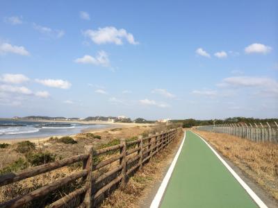
Starting in Mizohori, Nogata City and ending in Anya, Wakamatsu Ward, Kitakyushu City, the General Prefectural Road Nogata-Kitakyushu Bicycle Path is a 34.6km bicycle and pedestrian road.
There's also the General Prefectural Road Onga-Munakata Bicycle Path, which is a 33.9km bicycle and pedestrian road that starts in Onga-cho, Onga City and ends in Taguma, Munakata City.
These two bicycle paths have been maintained since 1984 to ensure safe bicycle transit and help foster the sound development of mind and body.
This bike path traverses the Onga River's riverbed, connecting Ashiya-cho ~ Wakamatsu Ward, Kitakyushu City, as well as Ashiya-cho ~ Munakata City.
Because it is possible to enjoy a variety of seasonal scenery along the bike path, this path is used by many people for cycling, walking, jogging, and more.

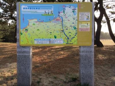
Bicycle Path Overview guidance board
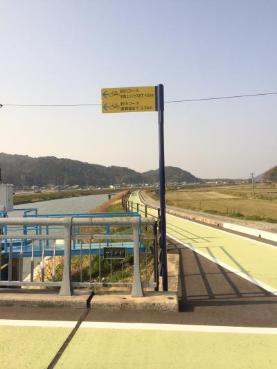
Guidance signboard
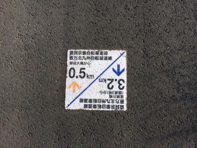
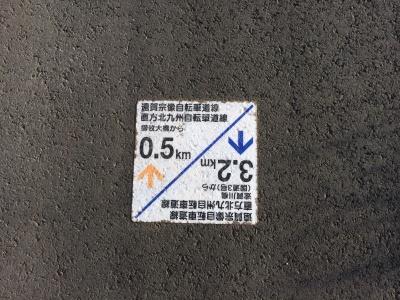
Distance Marker


- Section
- Nogata-Kitakyushu Bicycle Path: Mizohori, Nogata City ~ Anya, Wakamatsu Ward, Kitakyushu City. Onga-Munakata Bicycle Path: Onga-cho, Onga City ~ Taguma, Munakata City
- Distance
- 34km
- Inquiries
- Fukuoka Prefecture Kitakyushu Prefectural Land Development Office
Tel:093-691-2736
Fax:093-691-2921
- Related Files
- Other
- Nogata-Kitakyushu Bicycle Path: 34.6km
Onga-Munekata Bicycle Path: 33.9km
The broken line on the map above is currently being serviced, so please detour around this area.
During times of construction, traffic will be restricted via signboard, etc.
As such, we ask that you cooperate by following the instructions listed on such signboards.