
- HOME
- Cycling Courses
- “Kuma River Route” into a landscape shaped by the majestic flow of the Kuma River
“Kuma River Route” into a landscape shaped by the majestic flow of the Kuma River
Number of Hits:23
※The road is currently closed to regular vehicles due to ongoing restoration work following the torrential rains that struck the area in July 2020. (As of March, the 1st, 2024)
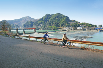
The vibrant green Kuma River ranks among Japan's top three fastest rivers. This scenic route commences at Kumamon Port Yatsushiro, located at the mouth of the Kuma River, and stretches along its banks to Kuma Village. Ideal for beginners, the path features gentle slopes and offers stunning views of the Kuma River's breathtaking natural beauty. Along the way, you'll encounter numerous attractions including roadside stations, historic hot spring resorts, limestone caves, and other scenic spots perfect for leisurely exploration. Although the Kuma River basin suffered significant damage during the July 2020 downpours, we aim to support its recovery by visiting this route once it reopens to traffic, in hopes of bringing smiles back to the local community as soon as possible.

①Kuma River Route

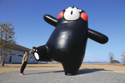
②Kumamon Port Yatsushiro

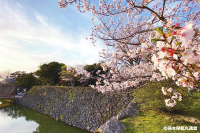
③Yatsushiro Castle Ruins

④Yatsushiro National Fireworks Competition Festival

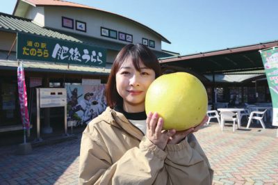
⑤Banpeiyu

- Section
- Kumamon Port Yatsushiro - Ashikita Town/Kuma Village Boundary
- Distance
- 48.4km
- Inquiries
- Kumamoto Prefecture Southern Prefecture Regional Headquarters Promotion Division
1660 Nishikatamachi, Yatsushiro City
TEL:0965-33-3149
FAX:0965-33-3174
E-mail:nansoushinkou26@pref.kumamoto.lg.jp
URL:https://www.pref.kumamoto.jp/site/kennan/166557.html
- Related Files
- Other
- ※The road is currently closed to regular traffic due to restoration efforts following the 2020 Kyushu floods (as of March 1, 2024).